Pages

Zero Day in Port Jervis


Day Five
Friday, September 30, 2016
Zero Day in Port Jervis
Holed up in the Day’s Inn  in Port Jervis.  Ate leftover pizza for lunch and ordered Chinese delivery for dinner.  Stayed in all day and rested.

Rutherford Shelter to Lott Road


Day Four
Thursday, September 29, 2016
Rutherford Shelter to Lott Road
11.7 miles

It rained again last night with cold wind blowing, flapping the sides of the tarp.  I dreamt that a bear was standing at my side of the tent and hitting it with his paw.  I could see his silhouette very clearly.    I awoke myself and Wait-up trying to scream. 

Although it was a short day today, it was hard for us.  The first part of the day was rocks, rocks, and more rocks.  Rocks are getting really old, we are not getting much sleep, and we both have blisters.


Observation Tower
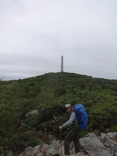
High Point Monument
 
 
High Point Monument
At High Point State Park office the kind lady gave us a cup of coffee.  We have been missing our hot coffee in the mornings because we chose not to bring our stove with us in order to save weight since we have to carry more water.  And since it is cold and wet, the coffee was a very welcomed treat.  She also offered us a complimentary Pepsi, provided by a friends of hikers group in the area to thru-hikers.  She said we qualified, since we are doing a long section.  Another thru-hiker came in and she made him the same offer and he said, “Can I have both?”  Huh, we hadn’t thought of that.  Wish we had. 

We saw and took pictures of High Point Monument, the highest point in the state of New Jersey at 1803 feet. 

Between High Point State Park and Lott Road, it seemed like we were crossing a road every few minutes, 8 of them within 8 miles. 

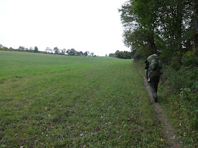
The last 3 or 4 miles before Lott Road, we finally got out of so many rocks and found rolling pasturelands and boardwalks.  Still, it was a long 4 miles before we reached town and we were again exhausted.  We reached Lott Road or Jersey Avenue and walked .4 downhill into Unionville, New York. Local folks will know that although we are hiking New Jersey, almost immediately when you leave the trail and head toward town, you enter New York.  The A.T. is right on the borderline for several miles in this area.


We had planned to resupply in Unionville at Horler’s Store and camp in the Unionville Memorial Park where we had read that we could get a cold shower.  Although I was not looking forward to a cold shower, I thought it would be at least enclosed.  No, the lady in the store told us it was a water hose outside.  Oh my! 

As we sat on the front porch of Horler’s weighing our options, talking to the store employees and several customers about places to stay in the area, we had the good fortune of one of the store clerk’s offering to take us to a Day’s Inn about 15 minutes away in Montague (or Port Jervis).  We don’t know how will get back, but right now we just wanted to get there and take a day off tomorrow.  Wait-up needs to get some sinus medication, we need to treat our blisters, and we need to rest.  We’ll worry about getting back when the time comes. 

So Kelly drove us to Day’s Inn.  We ordered pizza delivery then walked down a hill to Shop-Rite to get medicine and resupply.  While in line at the check-out, the lady in front of me started talking to me and found out we were hikers staying at Day’s Inn.  She offered to drive us back up the hill.  Score!  Two trail angels in one day!  God is good. 

Brink Shelter to Rutherford Shelter

Day Three
Wednesday, September 28, 2016
Brink Shelter to Rutherford Shelter
14 miles

 
We arose and quickly got on our way, as we were planning to hike about three miles then have breakfast at Gyp’s Tavern or Sunrise Appalachian Trail Deli in Branchville.  They are supposed to be right on the trail.  When we got to the deli there was a sign on the door saying it was temporarily closed and recommended we go to Gyp's Tavern right down the road.  Our hiker’s companion said Gyp's opened at 9:00 a.m., and we would be just in time.  HOWEVER, when we got there, there was not a soul to be seen.  They were not opened.  We went next door to a Sport’s Shop and asked them, they said Gyp’s opened at 11:00.  We quickly surveyed the place and found the only thing they had to offer us was a soda, which we took advantage of, but that’s not breakfast.  We asked about other restaurants and they said there was one about a mile the other direction.  We asked about a local taxi service (not wanting to walk an extra two miles) and were told that the closest taxi charges $40 just to come here.  Oh well, we sat on a rock outside and ate a Clif Bar along with our soda.  What a disappointment.  But this is not the only time we will be disappointed on this trip, expecting a deli and the deli being closed. 
Gyp's Tavern
Gyp's Tavern


We filled our water bottle from their restroom and got back on the trail.


We saw a small card on a tree advertising a new hostel in the area.  I took a picture of it just in case we needed it.  It said he/she was a former thru-hiker and would pick up at High Point State Park.  We later tried to call the number to see if we could get a ride from Unionville and did not get an answer. 
As we climbed to the top of Sunrise Mountain, we suddenly found ourselves on the top looking at a pavilion.  It seemed so out of place from this side, but we found out that there was a parking lot not too far from it on the other side.  Several men loitered around the shelter, looking at the view.  I remembered reading in Jennifer Pharr Davis's book, "Becoming Odyssa" that she had come upon a hanging victim on Sunrise Mountain at a pavilion and realized that this was the very location. 
Sunrise Mountain Pavilion
View from Sunrise Mountain


At Mashipacong Shelter we again found water in a 5-gallon jug.  Luckily we didn’t need any.  We trudged on, planning to stay at Rutherford Shelter.  Finding that it was .4 off the trail, we set up a stealth camp instead.  In fact, we didn’t stay in a single shelter this whole trip. 

Catfish Fire Tower to Brink Shelter


Day Two
Tuesday, September 27, 2016
Catfish Fire Tower to Brink Shelter
12.9 miles

It rained last night, but we stayed dry in our tarp tent with just enough room for our two sleeping mats and our gear to be covered. 

Down the hill and right before the road crossing, we came upon Rattlesnake Spring which we had been told was running – it was not – it looked stagnant.  However, at the road crossing of Road 602 we found a six-pack of water left on the picnic table by trail angels.  We topped off our water bottles and proceeded.  Just a few steps further on the trail, we saw a five-gallon bottle of water.  With a number of south-bound thru-hikers in the area, this would prove to be helpful.  Thank you trail angels! 

It was steep going up to a power line and with the rain last night, Wait-up slipped on a wet rock and landed on his left hand and bent his finger back.  It was, luckily, not broken. 

We saw a huge porcupine going down the trail in front of us, and I tried my best to get a picture of it but failed to do so.  I sure didn’t want to get too close to it.  Finally he waddled off into the woods.

The views today were unfortunately shrouded by fog.

It was a hard day today, both mentally and physically.  With every step I took, something hurt.  Either my toes jamming against the front of my shoes, the bottoms of my feet with my usual pain at the base of my toes, new blisters on the side of my heels, my shoulders from the heavy backpack packed with 4 days of food and 2 liters of water.  I was beginning to think, “what am I doing here.”  Then I decided that I had a choice – I could moan and groan or make the best of the situation and enjoy it.  The joy of the Lord is my strength!

We passed three different southbound thru-hikers.  They are easily identifiable by now.  They just have that look about them, plus their backbacks and beards give them away.

We went about a mile past Brink Shelter before stopping for the night.  Very tired!


Delaware Water Gap to Catfish Fire Tower

Day One
Monday, September 26, 2016
Delaware River Bridge to Catfish Fire Tower
12.7 miles

This morning, we met George Lightcap, our shuttler, at Tiorati Circle/Arden Valley Road at 7:00.  We had met George back in 2013 at Mountain Harbour Hostel at Roan Mountain, TN the day before he completed the AT after 28 years of section hiking.  He had told us then to look him up when we got to New Jersey, which we thought at the time it would be forever for us to do.  But low and behold, here we are in New Jersey! 

It was a new experience for us to be so far from our car.  We typically do three days/two nights at a time before we reach our car.  This time we are stretching it out to seven days.  That will make us feel more like a thru-hiker for sure!

George delivered us to Delaware Water after a pleasant ride and good conversation.  We also saw a bear crossing the road somewhere in New Jersey as we drove south.  Before crossing the Delaware River Bridge, we felt the need to go to the bathroom, so rang the bell on the door of the Bridge Toll Plaza to see if we could use theirs – mistake!  A lady came to the door and I asked if they had a public bathroom and she said, “No, but I’ll let you use ours.”  And she let us in and directed us to the restrooms.  Before I could finish up though, she came in and said, “I hate to rush you, but we are not suppose to let people in.” And she stood and watched me until I could get everything together and get out of there.  I guess someone had said something to her about letting us in.   I felt like a criminal.  So we got out as quickly as we could, and proceeded across the Delaware River Bridge.

We started hiking at 9:00.  The weather is crisp and cool, about 44 degrees.  We started out with long sleeves, but that didn’t last long.  Our packs were fairly heavy at this point – about 34 pounds for Wait-up and about 27 for me.  We were carrying 4 days of food and 2 liters of water for each of us.  It has been a dry summer for New Jersey and we had been hearing that the water sources were dry, so we had to be sure to carry enough water until we reached the next sure water source. Sure enough, for the next several days, we did not see running streams but a couple of times. 

It was exciting to see the Delaware/New Jersey state line about half way across the Delaware River Bridge.  Here we go!

Immediately after crossing the bridge, we came to the Kittatinny Point Visitors Center before crossing the road and heading into the woods.  We could have used the bathroom here!  Plenty of parking available too. 


The Sunfish Pond is a well-known landmark on the trail.  It is the southernmost glacial pond on the A.T. and one of seven protected natural areas in New Jersey.  It has a bench conveniently located, just right for viewing the pond and resting awhile (and taking a selfie).  Just north of Sunfish Pond we crossed the only flowing water we will see for several days.
 
On the shore of the pond, a little further north, is an interesting "cairn field", ha ha.  (Not to be confused with a "corn field.")
See the rattlesnake?
We saw our first rattlesnake on the trail somewhere along here.  He was curled up beside the trail with rattlers rattling big time.  We tried to scare him away, but he would not budge.  Wait-up finally edged around him on the trail, but I made a BIG detour and got around him through the woods.
Rattlesnake! 

The terrain proved to be much like we had left behind in Pennsylvania, rocky trails and more rocky trails.


Mohican Outdoor Center
We reached the Mohican Outdoor Center at 3:30 and took a nice long break there, taking advantage of the running water to eat dinner, brush teeth and fill up our water bottles for the night and next day. 

After about an hour at the Center, we went on up to Catfish Fire Tower and a little beyond set up our tarp tent for the night.  We stopped around 6:00 p.m.  We went to bed listening to the locusts making a deafening fuss, but not much sleep again because of Wait-up’s nose running all night. 


Mohican Outdoor Center

 
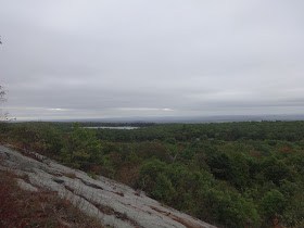
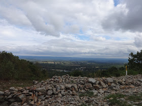
Here are some views from the trail. 


Day Before Hike


Day Before Hike
Sunday, September 25, 2016

This will be our 9th section hike.  We started in the Fall of 2011 at Springer Mountain, Georgia, and have hiked 1293.2 up to the Delaware River Bridge where the Pennsylvania/New Jersey State line falls in the middle of the bridge.  We have seen some beautiful countryside from a vantage point that few people are privileged to experience.  Some people think we are crazy, some are in amazement, and some are envious.  We count ourselves blessed to have good health and the ability to do what we are doing.  These adventures – both enjoyable and not so enjoyable – make good memories and these memories are ones that only Wait-up and Catch-up can rehash over and over again.  We come home each time thoroughly exhausted, but we don’t get home before we start talking about our next journey. 

We have done minimal training for this section, but we feel confident that we can make up for it by planning fewer miles the first few days, and by the fact that the elevation is not that bad.  Wait-up has just come home from an elk hunting trip in Colorado where he had more elevation and tougher days than we will have, plus he did do some training with his backback before he went hunting.  So we figure he should be in shape by now.  Catch-up (me) also did a little training with my backpack, but not nearly as much as usual.  The summertime in Florida is very hot, and hard to make yourself get out there and do it. 

Before starting this section, we were figuring our remaining miles.  “Someone” had the thought that, if we could do 300 miles for the next three times, we would be finished.  That would be wonderful, since we have so far to drive now from Florida.  So we began to put that plan into place.  This hike would cover New Jersey, New York, Connecticut, and Massachusetts for a total of 299 miles.  We had no doubt that we could do that mileage.   

We also planned our itinerary to be in the woods for longer stretches of time – seven days instead of our usual three or four.  We will really begin to feel (and smell) like thru-hikers by the end of seven days!  This was due to the fact that shuttle drivers and hostels are fewer in these upper states than they are in the south.   It’s not very feasible to have a driver come a great distance to take us only a short distance up the trail. 

Other changes we have made this time include, leaving our stove out and eating cold meals and using a tarp to construct a tent.  This is due to the fact that there has been a drought this summer and the water sources are dried up.  We will have to carry more water with us for further distances, making our packs heavier.  We need to save weight where we can. 

Wait-up was suffering from a sinus problem which got worse when we got in the wet, cold woods. He didn’t sleep well because of it and it would prove to be a hindrance.

So – I’ll go ahead and give you the end of the story now.  We both struggled, both mentally and physically the entire 15 days.  As it turned out, we only did 162 miles through New Jersey and New York.  Which, of course, is nothing to be ashamed of,  it’s just not what we planned for.  Granted, both states were pretty challenging with a lot of rocks, but so was Pennsylvania and we had a great time there.  What was so different about this time?  We couldn’t have gotten that much older in 5 months time.  In hind sight, we should not have planned our first week to be seven days out without a break, since we were not in good condition when we started.  Seven days out from the car turned into nine and we were never so glad to see the car when we finally reached it.  Perhaps we should have waited a while longer after Wait-up’s elk hunting trip – maybe he was still run down from that.  We should have taken some sinus medications with us.  We should have taken our stove – we both decided that it would have been advantageous to have a hot meals morning and night.  It probably would have helped with the mental struggle (comfort food, you know) as well as the physical.  We both got tired of the cold food and lost our appetite for it. 

Our daily mileage was around 12 miles, usually it’s closer to 14.  We hiked for 13 days, with 2 days off.  We were 4 days behind our planned schedule when we stopped in Wingdale, New York – 162 miles.  We both agreed it was time to call it a day. 

So here goes our story about New Jersey and New York:
On Sunday, September 25, 2016, we drove to Tuxedo, New York – a distance some 18 hours or 1200 miles from our house in Florida – made more manageable by a stopover in Knoxville, TN where our daughter, son-in-law, and granddaughter live.  Tuxedo is a little spot on the map, identified in our Hiker’s Companion as the crossing for Southfields, New York or Harriman, New York.  Anyway, we chose this location because it is located near the end of where we wanted to hike to on the first leg of this section, so we could leave our car.

The Tuxedo Motel had good reviews, so we felt fairly confident about staying there.  Upon checking in after dark on Sunday night, we found it to be okay.  The check-in process is a little different – the clerk was behind a caged-in window.  He directed us to our room around the corner, which was a typical motel-looking setting.  It had a walkway running along in front of the rooms, which smelled heavily of cigarette smoke as we walked to our room.  We thought, uh oh, this is not good.  But when we got to our room we were pleasantly surprised to find that it did not smell of smoke.  It was clean smelling and in good order.  Nothing fancy, but nicer than some we have stayed in.   The shower was clean and adequate.  We found the two double beds to be hard, but clean. That, plus the sinus problem Wait-up had, led to a pretty sleepless night.