Greasy Creek Gap to Carver’s Gap

 
May 20, 2013
10.4 miles
10:00 a.m. to 8:00 p.m.
 
 Mr. Terry from Mountain Harbour drove us down to Greasy Creek Gap to go north this time.  We had an opportunity to meet Connie, the owner of Greasy Creek Friendly.  Seemed like a nice lady, and folks we met who stayed there said it was a very friendly place. 

Oh my gosh! Tough day today.  The climb up Roan Mountain I thought was going to kill me.  We went from an elevation of 4034 at the gap to a high of 6275. The first half was not too bad since it had lots of switchbacks; but the second half was steeper and very hard.  We saw markers that looked like they are planning to make more switchbacks in that section, which is a very good idea.   


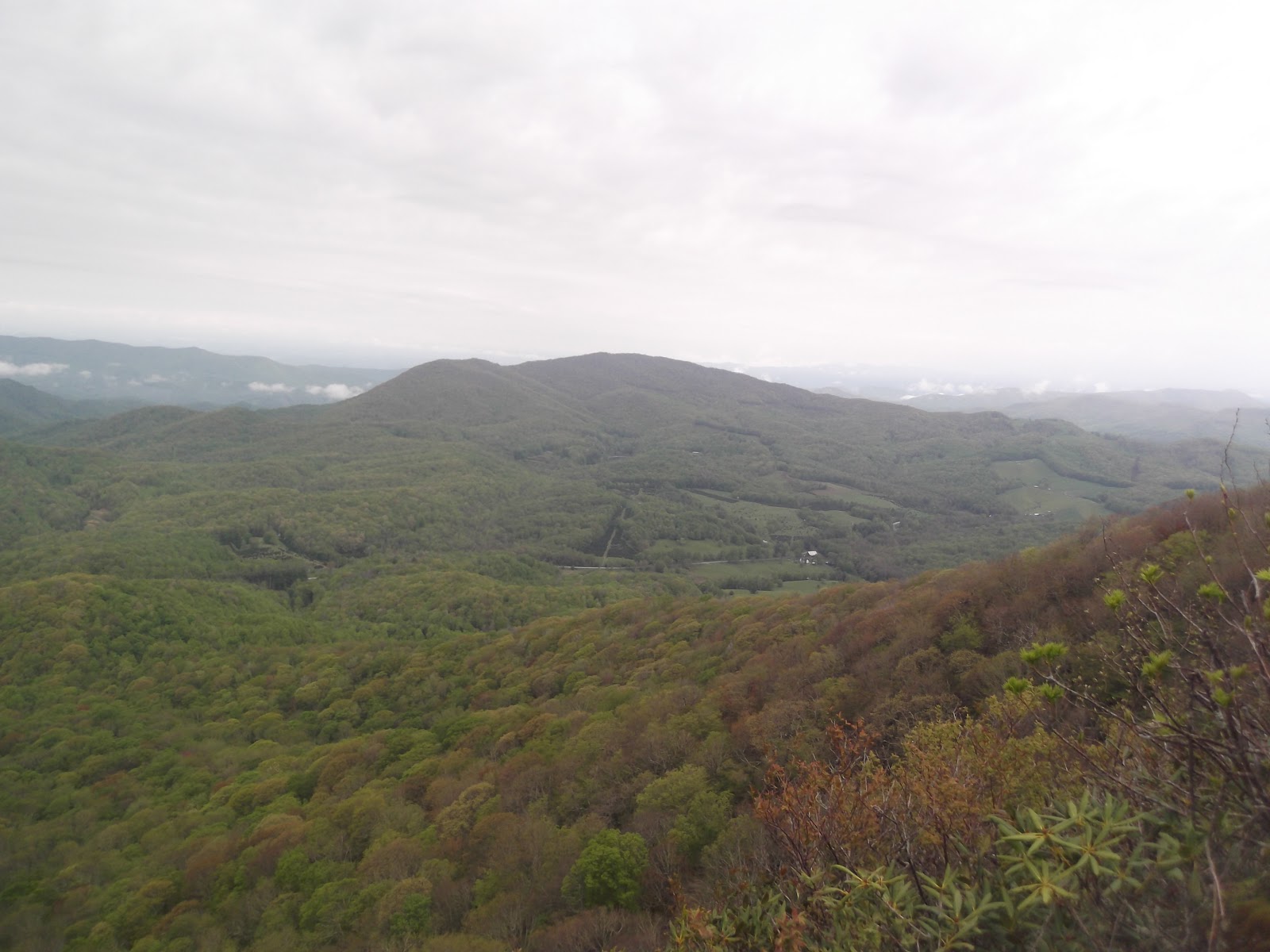
A view from Roan Mountain


A view from Roan Mountain


On Roan Mountain
 

Our Thru-Hiker's Companion told us that this is the last time the AT climbs above 6,000 feet until Mt. Washington in New Hampshire, and it is arguably the coldest spot, year-round on the southern AT.  It was not cold today.  It also said that at the top is a parking area with restroom and running water (May – October).   As we approached the top we saw signs telling us that there would be no water or facilities at Cloudland until May 23.  Too bad for us. 

We entered a clearing with a monument telling us that this is the site of the former Cloudland Hotel.  The Tennessee-North Carolina state line ran through the center of the hotel when Cloudland was a thriving resort in the late 1800s and early 1900s.  This allowed the sale of alcohol on the Tennessee side and the comical tale of North Carolina police officers patrolling the other side. It was demolished in 1915 after loggers harvested the fir and spruce on the mountaintop. 

The site of the former Cloudland Hotel on top of Roan Mountain

Rhododendron bushes flourish on the top of the mountain and there is a popular garden on the top of Roan when they are in bloom around June 20.  We did see a few bushes just starting to pop out into bloom all along the trail, but missed the peak season.

 When we got to the top of the mountain, I was feeling so bad and was so tired I could hardly walk, and could not eat a thing.  We made it to Roan High Knob Shelter. Another young man caught up with us there and was in total agreement that it was a hard climb up the mountain.  Unfortunately for us, the water source was downhill from the shelter and Wait-up had more climbing to do to get to it. 

Roan High Knob Shelter

Roan High Knob Shelter is the highest on the Appalachian Trail and was originally an old firewarden’s cabin.  This explains the four walls and the door, unusual for shelters.  The young man was staying at the shelter, but we had to push on so that our hike tomorrow would not be too long. 

 
We had heard so many good things about the Roan Mountain area being so beautiful that we were looking forward to it; so far we have been disappointed.  I had not seen any beauty yet.  The trail down from Roan Mountain was an old railroad bed with lots of rocks.  We trudged along.  We met a man with a large camera coming toward us who told us that we were about to come to the balds and they were beautiful.  We reached Carver’s Gap without seeing them yet, finding out later that they were on the other side of the gap.   

We crossed Carver’s Gap and sat beside a fence on the other side for Wait-up to eat supper.  I again could not make myself eat anything, my stomach was really feeling bad by this time.  He suggested us calling for a ride to go back to Mountain Harbour, but I thought if I could just get to a campsite and go to bed I would be fine.  So we proceeded up the hill to try to get to the campsite 2 miles down the trail. 

The good news is, we finally found the beautiful bluffs, I just couldn’t enjoy them because I was feeling so bad.  So bad, in fact, that I got to the point I could not walk another step.  I had to stop.  We were on top of the first bluff called Round Knob.  We began to look for a place to pitch the tent.  We wandered around for awhile trying to find a level spot and finally gave up. We pitched the tent off the trail on top of briars and roots and on a slant.  It was the best we could do. 

Not long after we got into the tent, Wait-up had to throw up.  Huh?  I was the one that was sick.  Now he was too.  He threw up 3 times during the night.  I finally threw up too and felt a little better after having done so.  But we didn’t sleep much that night and knew that we would not be hiking the next day.
Carver's Gap
 

At Carver's Gap
 
A road from Carver's Gap goes up to the gardens.


Beauty Spot to Erwin, Southbound

May 19, 2013
10.6 miles
7:00 a.m. to 1:00 p.m.


Raining again.  We stuffed our wet stuff into our backpacks and left the campsite by 7:00 a.m.  It was very foggy as we crossed over another knob that could very easily have been Beauty Spot.  We never were sure exactly where Beauty Spot was, several places in this area could have been labeled that. 


We met a young man on the trail who was visibly upset and was crying about something.  He muttered something about Damascus and I said yes, we were headed to Damascus.  He told us that there had been a tragic event at Field Days in Damascus.  An elderly man in an old Cadillac plowed into the parade and struck several people. He knew some of the people and he had to keep going, and with that he hurried on down the trail. ( http://bigstory.ap.org/article/witnesses-car-strikes-crowd-va-parade) We had not heard any news out here on the trail, so we didn’t know anything about this incident. 
We came to Curley Maple Shelter and had trouble determining where the trail went from there.  There were several paths leading away from the shelter, as usual.  One usually went to water, one to the privy, or in this case - there being no privy – to the toilet area.  We went on down one of the trails and finally found a white blaze.


Curley Maple Shelter

Sitting beside the beautiful creek.
From here there was about 4 miles of leisurely walking beside a creek.  Aw – nice!  We met a couple of men coming to meet us going north who said we would coast into Erwin the rest of the way.  Well - it didn’t quite turn out that way because there was the dreaded one last UP before we got to the railroad tracks.  We also met Harry for the first time coming out of Erwin going north.  He spoke in broken English and asked us how far to the shelter.  We told him but I’m not sure he understood.  More about Harry later; we saw him many times on the trail after today. 
Lots of bridges like this in this area.


On the final descent, Wait-up took his boot off to check why his feet were hurting so bad.  Look at the picture and you can see why.   The wet boots, socks, and feet for the last couple of days lead to some blisters for both of us.  The first time we have had this problem. 
Oops, blisters!


After the final climb up and down, we crossed the railroad tracks and then the bridge going over the Nolichucky River and this time approached Uncle Johnny’s hostel from the north. Got there at 1:00 – always a welcome event to finish early in the day and have time to rest up.  Plus, it gives us time to move on up the highway and find a place to stay and leave our car.  This time we drove up to Roan Mountain Road where we had a semi-private room in the hostel of Mountain Harbour.  Good thing we called ahead, space was at a premium every night there.


Crossing the railroad tracks before coming back into Erwn.

The trail crosses the Nolichucky River bridge.

The Nolichucky River.

Greasy Creek Gap to Beauty Spot, Southbound

May 18, 2013
13.7 miles
9:00 a.m. to 4:30 p.m.

We woke up to a rainy day of hiking.  It was nice to meet Tom “10-K” Bradford today since I have seen his posts of Whiteblaze so many times and seen him mentioned in other hikers’ online journals. He picked us up at Nolichucky River where we left our car and shuttled us to Greasy Creek Gap to begin our hike.  At Greasy Creek Gap there is a well-known hostel called Greasy Creek Friendly.  Evidently she named it that because of a hostile neighbor who has given her some trouble so she wanted hikers to know that it was a friendly place. 


When we arrived at the gap, I went up to the porch to ask how to get to the trailhead.  There was a note on the table beside the door which said, “I am gone to trail days in Damascus.  Please help yourself to the hostel or the front porch.  Please don’t pee in my creek.”  Okay.  We didn’t get to meet Connie today.

So we started walking up the old jeep road behind the house to find the trailhead.  The bunkhouse is behind the house and there were a couple of hikers in the yard.  We asked them if we were headed in the right direction and they said yes.  We asked them if the trailhead was easy to find at the top of the hill and which way do we turn?  The lady said, “Well I’ve never been up there, but it’s easy and you turn to the left.” Okay.

After a few guesses on which path to take as we went up the hill, we found a campsite and the white blaze.  Wait-up pulled out his compass to help us find the southerly direction.  It said turn right on the trail.  Umm, that didn’t seem right.  Plus the lady said turn left, although she had never been up there. What to do?  I was thinking  - Have we ever gone north on the trail to go south?  Of course we have; the trail switches around all the time.  So, do we trust our instincts or go with the compass?  I thought about calling someone from one of the hostels to ask, but we didn’t have cell phone reception.  While I was wondering around on top of the mountain to see if I could get reception, I found a note on a tree with a “You are here” map.  We were able to determine from the map that we do indeed turn left to go south.  So off we went.    

We got to Iron Mountain Gap in record time – 4.2 miles in 1.5 hours.  Wow!  That was the first time we saw people to ask them if we were headed south, but we were glad to have them confirm that we were.  At 1:00 we met a nice brother and sister middle-age couple at Cherry Gap Shelter. Evidently they were trying to wait out the rain. 


The sign at Iron Mountain Gap


Just past Cherry Gap Shelter while I was stepping over a fallen tree on the trail, I heard a noise down the side of the mountain.  I immediately said, “What was that?”  Wait-up and I looked down the ravine to see a small bear scampering away down the hill.  He then climbed a tree while we were watching and looked back at us to see where we were and what we were doing.  We were just standing there watching him since we were not close to him.  When he spotted us again, he scampered down the tree and went away.  Too bad I didn’t have time to get my camera.  This is the first bear that Wait-up has seen on the trail, my second.  I saw one in Georgia. 
Having lunch under the overhang of a rock.
We had a hard time finding a dry place to eat lunch.  Resourceful Mr. Wait-up finally found a rock overhang and we were able to stay a little dry while eating. 

Then we started making the climb up Unaka Mountain.  It was a rocky path and a typical mountain.  When we reached the top of the mountain we came into a forest.  A spooky forest.  Since it was rainy and cloudy, it kinda looked like a haunted forest.  I was glad to exit it.  


Unaka Mountain was spooky in the fog.

 
When we came out on the other side of the forest, we met a man who seemed to be somewhat disoriented. He had already set up his tent for the night although it was early in the day. He told us that he had been lost, wondering around the mountain.  He was suppose to camp at a site before the mountain but couldn’t find it. We asked if he was alright and he said no, he was out of water.   Wait-up emptied his water bladder into the man’s water bottle so he would have water to prepare his evening meal.

We planned to camp on Beauty Spot.  We had to stop at the first available watering hole to resupply.  There was a nice campsite beside Highway 230 but, since we don’t like to camp beside roads, we got water and moved on.  It was hard to tell exactly where Beauty Spot was.  The highway ran alongside the trail off and on and in our book we saw USFS 230 listed twice along with Beauty Spot Gap and Beauty Spot.  And there was also a Deep Gap listed there with a campsite but it must have also been beside the road. Since it was raining and foggy, we couldn’t really see much of Beauty Spot anyway, so we finally just found a level spot in the woods and set up our tent in the rain.  Everything was wet by the time we got up the next morning.

Spivey Gap to Erwin, northbound

May 17, 2013
11.2 miles
7:00 a.m. to 1:00 p.m.

The benefit of camping in the woods vs. staying at a hostel is the early start in the morning.  We were on the trail by 7:00 a.m. and had a mostly downhill walk.  I say “mostly downhill” because I have learned never to say “downhill all the way.”  There is no way it can happen in the mountains.  But today was relatively easy and mostly downhill back to the Nolichucky River in Erwin where we had parked our car. 


No Business Knob Shelter


We passed No Business Knob Shelter and saw our first Mountain Laurels in bloom. 


We heard the train in Erwin long before we got there.  The view of the river below us and the train track running across it was a beautiful sight, so I took lots of pictures of it.  It’s funny that you can see what is below you a LONG time before you get there.


A look at the Erwin train track going over the river.

The weather got warmer the lower we descended until we were sweating pretty good by the time we got there.  A nice cold Pepsi from the machine was a welcome treat.

There was a train on the track, it seems to run quite often.
We went to the Holiday Inn Express and checked in for the night before heading out to eat at The Farmer’s Daughter restaurant south of Erwin.  Aww – the most food we have eaten in a long time, family style service.  Awesome! 


The sign where the trail crosses the highway at the Nolichucky River.


Sam's Gap to Spivey Gap Campsite, northbound

May 16, 2013
13.4
8:30 a.m. to 4:45 p.m.

We’ve been to Sam’s Gap before.  In March when we started at I40 north of the Smokies, we intended to hike all the way to Erwin, but stopped at Sam’s Gap because of the weather and because of sickness of relatives at home.  At that time, we came to Sam’s Gap and went south to Log Cabin Road after camping on Big Butt in the snow.  This time, we will be hiking north to Erwin. 


Sams' Gap

Entering the trail at Sam's Gap going north.
 

We had a young shuttle driver from Uncle Johnny’s take us to Sam’s Gap.  We started up the hill from the gap at 8:30, elevation 3850.  It was up most of the way to Big Bald, elevation 5516.  We were, of course, tired when we got to the top of the bald and sat down to rest.  In a few minutes, here came a family – mom, dad, and three kids running around and a baby in a backpack on dad’s back.  They looked like they had all the energy in the world after coming up to the bald, and it wasn’t their first time up there. They were on vacation and had hiked up to the bald the day before as well, but this time they said they had found a road that had put them pretty close to the top. They took our picture with the sunglassed pole before we moved on down the other side of the bald.
We went downhill for 1.5 miles, then started going back up to Little Bald.  When we started descending again we thought it was for the last time before reaching Spivey Gap, but NO! When we saw The Trail to High Rocks we knew we had 2 more miles to go before the gap, so we stopped at a campsite for the night.  Do you think we took the trail to the high rocks? NOT!
 

The view on the trail to Big Bald


On the trail to Big Bald.
Beautiful flowers and blooming trees on the trail.

On top of Big Bald.
On Top of Big Bald


Zero Day in Knoxville and Erwin

May 15, 2013
Knoxville and Erwin, TN

0 miles

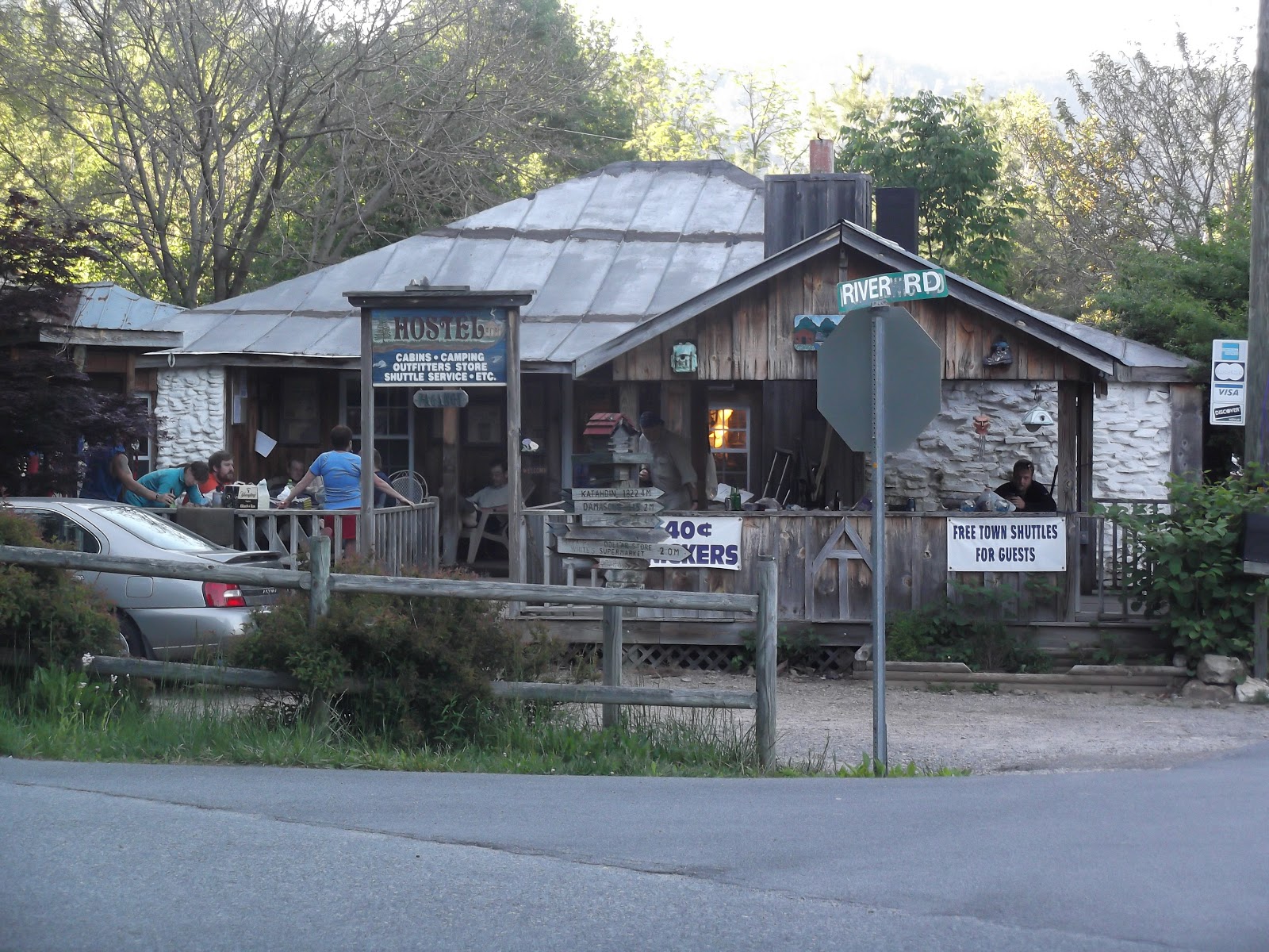
We woke up in a regular bed and boy did it feel good to get a good night’s sleep.  We rested most of the day and in the afternoon prepared to leave to go on up to Erwin for our next section.  We booked a private cabin at Uncle Johnny’s Hostel in Erwin.  It looked good on the internet and seemed to be popular with other hikers from what we had read.  We arrived in Erwin around 4:00 and found River Road and Uncle Johnny’s.  Obviously, from the number of hikers there, it is as popular as it appeared to be.  However, we were somewhat disappointed in the cabin we were in.  The sheets on the bed were paper-thin and the bed was pretty rickety.  We put our sleeping bags on the bed to sleep on and stuffed the pillows in our sleeping bag sack.  There were a lot of spider webs in the room too. We were beginning to wish that we had pitched our tent instead.  Uncle Johnny was really nice though and they did provide us with good shuttle service for the next several days. 


Uncle Johnny's hostel in Erwn, TN

The AT crosses over this bridge in Erwin, right in front of Uncle Johnny's

Our cabin at Uncle Johnny's, not our tent.

The bathhouse at Uncle Johnny's

The bed in our cabin.

The lawn and picnic table in front of our cabin.


Uncle Johnny inside his store.

Cosby Knob Shelter to Waterville School Road (I40), Northbound

Woke up to the sun rising at Cosby Knob.
May 14, 2013
10.4 miles
7:00 a.m. to 1:00 p.m.

It’s funny that we now consider 10 miles a short day.  Considering that back in Georgia it took most of the day for us to cover 8 or 9 miles, it is amazing that we can now do 10 miles by early afternoon. 


The trail was first uphill until we got to the side trail to the Mt. Cammerer Fire Tower, then downhill all the way. There were several trees down on the trail, one that we had to literally crawl under.


Yep, we walked that 31.4 miles from Newfound Gap.
When we reached Davenport Gap we had a most lovely site awaiting us – a TRAIL ANGEL!  Woo hoo! This guy was from Ohio and he does trail magic full time on 4 different trails.  He had a table set up with Famous Amos chocolate chips cookies and a bag full of different kinds of chips, and a cooler full of sodas.  My, my, did that ever taste good and was the perfect reward for making it through the Smokies.  He even had camping chairs for us to sit in.  Firemaker – I mean two-point-oh – a guy named Mark, Frizz and us were there about the same time and we all enjoyed a little break before heading on up the next mountain toward I40 and Standing Bear Hostel.  Us to our car and them to stay at the hostel for the night. 

The distance from Davenport Gap to Waterville School Road is 2.4 miles.  Anything can happen in 2.4 miles in the mountains.  We thought we were home free but, low-and-behold, when the walking was good and level, a root got in Wait-up's way and he went down - HARD!  He actually turned a flip right there on the trail.  Once a 35 pound backpack gets going in one direction, it keeps going.  His head hit the ground and his hand came down on a rock as he tried to break his fall.  Nothing was broken though, so he got up and we went on down the trail.  Too close to the end to stop now. 

We felt quite an accomplishment to have finished the Smokies finally after first planning to do them back last July when the heat wave came through and knocked us out of it. We were happy to be back to our car and on the way to Knoxville for the night to stay with our daughter and son-in-law for a short rest.
Wait-up surveying the goods at the Trail Angel table.
Frizz, Catch-up, Wait-up, and Two-point-oh enjoying trail magic.


The AT passes under I40.