Plumorchard Shelter to NC line and back to Blue Ridge Gap


Day Ten – Sunday, October 9
7.5 miles in 3.5 hours
Plumorchard Shelter to NC line and back to Blue Ridge Gap
For the first time this morning I felt no sore muscles in my legs. We hiked 4.4 miles to Blue Ridge Gap. 
We took one water bladder and some snacks, our camera and my journal and hid our backpacks in the woods.  Then we headed toward the North Carolina line.
Entering the Southern Nantahala Forest.

Going the remainder of the 3.1 miles up to the line was a breeze, wow! What a difference it made not to have a load of 35 and 45 pound backpacks on our back. 
We were surprised to see the tree in the middle of the trail and realize it was the tree that had the NC line sign on it in 1.5 hours!  We celebrated by taking lots of pictures of us and the tree, then sat down for a snack of cheese crackers and water. 
Our first view of the NC/GA line. 
Yee-Haw!  We made it!  The first 76.4 miles of the AT!
The little bag that Wait-Up was carrying was even lighter on the way down and he was leading the way, so we made it back to Blue Ridge in 1.25 hours. 
Like one old man said when we met him coming up the trail when we were going back down, “We're hiking machines by now!”  He and his wife also came from Springer Mountain and left the day before we did.
We then picked up our backpacks where we had hidden them and started walking down the rough gravel road to wait for our ride.  The walk down was rougher than any walking we had done today.  At the end of the gravel where the paved road started (about a mile down), we laid down and rested until Sally came and picked us up.  She was a welcome sight!  

The slag road at BlueRidge Gap we had to walk down to get to our last shuttle ride. 

When I got in the car, my leg started itching (my inner thigh to be exact).  By the next morning, I had a full-blown case of poison ivy on my inner thigh and it later spread to other surrounding areas…..
We booked a room at the Holiday Inn (no more Budget Inn for us!) with a king size bed and a Jacuzzi.   Awwwwesome!
We were on the trail for parts of 10 days, hiked about 8 1/2 days of the those 10 days.  Walked a total of 81.5 miles in 59 hours, a rate of approximately 1.4 miles per hour. 
We have already planned our strategy for next Spring.  We will park our car at Sally and Joyce’s house, have them shuttle us up to NC to some point depending on how long we want to hike and we will hike backwards to Blue Ridge Gap. 
Can’t wait for more adventure !

Sassafras Gap to Plumorchard Shelter

Day Nine – Saturday, October 8
10.7 miles in 8 hours
Sassafras Gap to Plumorchard Shelter
 The Lord saw that she was afraid of noises, so the Lord said “I’ll send the wind to blow so that she won’t hear the noises.”  And He did. 
The wind blew all night long so loud that she could hear nothing else. We slept like a baby in the middle of the wilderness, not knowing if there was anything outside to make noises.  Even when we awoke the next morning and broke camp, the wind continued to blow for most of the morning. 
My backpack felt like an old friend this morning when I strapped her on.  We were low on water again since we did not find water at Sassafras Gap, so we had Fig Newtons for breakfast.  BUT it made our pack lighter. 
At the end of the day yesterday I began to notice an odor that I had not noticed  before, uh, yea, it was warmer now and we did have a strenuous day, but I don’t usually smell like that when I sweat.  It finally dawned on me as I was walking today – I didn’t apply my deodorant when I showered at the Inn!  Ha ha, not a good time for that!  I guess I was too interested in getting started on that foot rub after the shower. We didn’t carry deodorant with us on the trail, of course, - to lighten the load, you know, so I would have to wait until civilization again.   In addition to that, I forgot to pack the sports wipes this time.  They had been a small effort toward a shower for us, but of course nothing like the real thing.  Now I didn’t even have those.  And, remember, I had stopped packing a change of clothes.  Oh well, we just have to live with the smell for now.  That’s the primitive life!
We bypassed Addis Gap, not knowing for sure that we would find water there and because it was .5 off the trail.  At 11:30, we made it to the streams right before Dicks Creek Gap where we found a beautiful flow of water coming out of a pipe right beside the trail.  Ah!  Finally we could have coffee!  We cooked our oatmeal and enjoyed our breakfast. 
The water source at the streams right before Dicks Creek Gap.
Us at Dicks Creek Gap.
4.5 miles more to travel today.


We got to Plumorchard Shelter about 4:15.  This one is known on the trail as the 3-star shelter, I guess because it has 3 floors.  We had traveled nearly 11 miles today in about 8 hours.  Although it was early to stop, we felt that we had done enough for the day and this was the best place to camp for the night.


3-star Plumorchard Shelter

In a little while a man struggled in and we laughed to see him fall out on the shelter floor from exhaustion.  It reminded us of what we had done at Blue Mountain Shelter several days before.  You do reach such a state of exhaustion sometimes that you can hardly move.  That’s the way he was, he said, “Just give me a minute and I’ll be okay.”  We knew exactly what he meant! 
He was shortly joined by 4 other men, coming in one at a time.  Two sets of brothers in the group.  They had come from the north and had traveled today from Standing Indian Shelter on the NC side of the line, about 12 miles.  It was interesting to hear the story of people along the trail.  These guys live in Raleigh, NC and they often take the end of the week off from work to hike the trail in short sections.  They started in Virginia and have hiked the trail south from there.  On this particular trip they left their vehicle at Dicks Creek Gap and were shuttled back up to Franklin, NC to hike south.  One more trip like this and they would make it to Springer Mountain to finish the southern portion of the trail.  Sounds like a fun thing to do on boy’s vacation, huh?  They had some interesting equipment, Wait-up was particularly interested in their hammocks and was inclined to get one for our next venture, but I am not convinced that I would like to sleep out in the open like that, although we tried one of their hammocks and they are very comfortable.
Knowing they had come from where we would be going the next day, we began to ask them about the trail.  They told a different story from the man and boy we had met the day before.  Their story was confirmed by the Hiker’s Companion.  The mountain on the other side of the line was 1650 feet above where we were now sitting.  Did we really want to hike 11.3 miles UPHILL on our last day of hiking????  I don’t think so.  We had to make it all the way to Deep Gap, US Forestry Service Road 71 since that was the first pick up point on that side of the line, or we could go to the line and turn around and come back to Blue Ridge Gap in GA to be picked up there.  Although we originally voted against backtracking, we now decided that was the better option to make our hike only 7.5 miles.  We would have to retrace our trail 3.1 miles from the line south back to Blue Ridge.  That also meant on our next time out, we start the trail in Georgia again, but, oh well, we’ll worry about that next time.  We had had enough for this time.  

Unicoi Gap to Sassafras Gap campsite

Day Eight – Friday, October 7
10.4 miles in 6.75 hours
Unicoi Gap to Sassafras Gap campsite
Change of plans, we didn’t leave our car at the inn after all.  After talking with Joyce and Sally we firmed up our plans to drive to their house instead of them picking us up at the inn.  They live just a few minutes out of town and it saved us $5 too!  Shuttles are really not that expensive though and are well worth the money. 
Us starting out fresh today at Unicoi Gap.
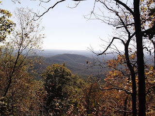
View from Rocky Mountain.

View from Rocky Mountain.


 So Sally took us to Unicoi Gap and we faced another steep climb up Rocky Mountain, rising 1068 feet above Unicoi Gap.  It always seemed to happen that the toughest climb was right after we had rested up, which, I guess, was a good thing.

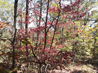
The colors are beautiful as we approach Tray Mountain.

Willie had told us that the upcoming section would be the toughest yet.  Again, Willie was right.  Climbing Tray Mountain was a lot harder than Blood Mountain, although Blood is a little higher (4450 compared to 4430). 
As we were approaching Tray Mountain we met a delightful couple on a day hike sitting on the edge of the mountain enjoying a magnificent view of a colorful mountain.  Those apples they were eating looked so delicious and refreshing – I wanted to grab it out of her hand!  We asked if we were on Tray Mountain yet and they indicated that it was the mountain in front of us – it was higher still that what we had reached.  So we lumbered on.    We had our meager lunch at Tray Mountain Road just before our final ascent.
The air on top of Tray Mountain had an odor about it.  We never quite figured out what it was, but it was very noticeable today.  Maybe it was decomposing plants or something.  There were also lots of flies and bees.  Tray Mountain is known as the southernmost breeding area in the US for Canada warblers. They live in the rhododendron thickets along the southern approach to the trail.  I saw just one.     
Blister showed up today! We have been very pleased with our boots and had no complaints with our feet at all- until today when a blister decided to pop up on one of my toes.  I guess it was all the steep downhills today which made my toes slide forward to the end of my boots.  I guess if that is all the foot problems we have we’ll be doing well.
At Sassafras Gap campsite we needed water and a place to stay for the night.  There was a water marker, but after trekking down the hill, Wait-up found the water source dry.  Oops!  Another night of rationing our water.  BUT – we did see a trail going up the hill and I found a nice established campsite not too far off the trail.  We decided to pitch our tent there instead of going on to Addis Gap, where the campsite was .5 off the trail and there might not be any water there either. 
While we were pondering what to do, a man and his son came by who had just hiked two 11-mile days to get from Deep Gap in NC to get to where we were now.  He told us that the trail on the other side of the line was fairly level and that it was not a bad 11- mile walk each day, so we decided then and there that we WOULD and COULD make it to Deep Gap, NC by Sunday evening.  We had a couple of nearly 11 mile days under our belt already, and seemed to be in better condition now than ever.  We could do this by Sunday evening!  Yay!

Blue Mountain Shelter to Unicoi Gap

Day Seven – Thursday, October 6
2.2 miles in 1.25 hours
Blue Mountain Shelter to Unicoi Gap


We had just a short trek down Blue Mountain to wait at Unicoi Gap for our ride.  We got there way early and waited on the hill for the van.  If we had known last night that we could make it in 1.25 hours, we might have pushed ourselves to get here, but, as I said, we were exhausted last night and didn’t know what was ahead of us.  Again, we thought about when we stopped short on Blood Mountain and again thought we could have been to Unicoi Gap last night if we had gone on to Neels Gap on Day 4.
One of the steep climbs we had today.  See the steps?
Willie got to Unicoi at 11:00.  We went back to the hostel and moved the car up to Hiawassee.  We had arranged our shuttle for the northern part of the trail through two very nice ladies named Sally and Joyce. 
First stop in town was the Huddle House where we had a late breakfast.  It’s amazing how good real food is by the time you have spent 7 days on the trail.
We had read in the Hiker’s Companion about Hiawasee Budget Inn in Hiawassee being hiker friendly and that they would let hikers leave their cars there if they stayed in the Inn.  So we went there.  Our first impression was – well, it IS a budget inn after all. 
We showered and did our laundry and restocked our backpacks for tomorrow’s hike.  We rested awhile before going back out to an all-you-can-eat buffet at Daniel’s Steak House.  Back to Daniel’s in the morning for another AYCE breakfast.  Man, it’s amazing how good food tastes! 

White Oak Stamp to Blue Mountain Shelter

Day Six -Wednesday, October 5
10.7 miles in 7 hours
White Oak Stamp to Blue Mountain Shelter
We got on the trail early this morning, even before breakfast.  Wait-up said when he looked back at me I had about two feet of leaves pushed up in front of my feet, I was dragging them so much.  Not a good way to start the day.  Starting out tired made it a long day.
We stopped later this morning for our breakfast of the yummy Big Sur bar and water, thankful again that we had a backup now for our oatmeal which required water to cook and we were now almost out of water. 

The water hole at Low Gap Shelter.

It was approximately 3.5 miles to Low Gap Shelter where we were counting on finding water – and a privy would be nice!  We found both. 


Oh the joys of a smoldering privy!  No squatting!  Squatting hurts when your legs are so sore.  It’s amazing what feels like a luxury out here in the wilderness. 
The privy.

The throne in the privy.
Interesting reading on the wall in the privy.

Yep, they have a camera in the privy. 
We enjoyed lunch on the picnic table at the shelter, then set out again.  For the rest of the day, it seemed that we were wondering aimlessly because this section did not seem to be marked with the names of the gaps and other landmarks as well as the other sections.  We were disappointed when we reached Chattahoochee Gap which was marked because we thought we had passed it long ago.  We have just about been able to determine by now where we should be based on how long we have walked, but we were deceived in this case.  Another fellow came along walking at a brisk pace and he too thought we had already passed Chattahoochee Gap.  I guess he was disappointed when he saw the sign several miles later too. 

At Chattahoochee Gap is the spring that is source of the Chattahoochee River, some 500 miles from this point, the river empties into the Gulf of Mexico. 
The ascent to Blue Mountain was very rocky and treacherous.  We were thankful again for our hiking boots and also our hiking poles.  The poles saved our necks several times from slipping and really gave us some thrust when climbing up.   We highly recommend the use of them. 

This was one of our fastest days for some reason, maybe because we traveled a good distance this morning without the weight of the water on our backs and the inclines were  not as hard as previous days.  In spite of a virtually sleepless night, we reached Blue Mountain Shelter by 4:45, but couldn’t go another step.  We were exhausted, having traveled 10.7 miles today in 7 hours. 

Since we were alone at the shelter, we decided we would forgo setting up the tent and throw our mats and sleeping bags out on the shelter floor to sleep.  The weather was more moderate now and not windy, so we were more comfortable outside.  Remembering the experience with mice at Blood Mountain Shelter, I placed my backpack between us on the floor hoping to keep the mice out of it.  NOT!  Immediately after dark, the mice started running around and Wait-up turned on the flashlight just in time to see one run right into my backpack.  I shook it until I thought there was no way that the mouse could still be in it.  We then took our backpack and hung them on the bear cable.

Lights out again.  Then a mouse jumped from the rafter right down on Wait-up’s sleeping bag and ran across it.  That’s it!  We got up and set up the tent after all.  We went to get the backpacks off the bear cable to put them in the tent with us.  As we took my backpack off the cable, we saw a mouse run out of it!  OMG!  They were everywhere!

Finally in the tent, we slept pretty well for the remainder of the night.  However, in the morning we found a hole in our tent where the mice chewed through and found some trail mix in the side pocket of my backpack that they had eaten most of!  Lesson learned – when there are mice around, make sure you take ALL the food out of your packs.  Man, those mice are relentless!  I don’t think I will be staying in another shelter!
Sunrise on Blue Mountain.
Blue Mountain Shelter


Blood Mountain Shelter to White Oak Stamp

Day Five – Tuesday, October 4
9.7 miles in 9.5 hours
Blood Mountain Shelter to White Oak Stamp
Sunrise on Blood Mountain

We got up before sun-up the next morning, rolled up our sleeping mats and bags, packed it all in and slipped out the window with the man still snoring in the front room.  Sure wish we had decided to go to Neels Gap with Jaybird last night!  Nevertheless, we were looking forward to getting a real breakfast at the Outfitter/Hostel at Neel's Gap this morning, so we held off on eating anything on our way down this morning.   
I used my trusty little mirror to discover that my eyes were very swollen – allergic reaction to the mice or the musky room?
The rocky trail leaving Blood Mountain.
Me coming down the rocky decline from Blood Mountain.

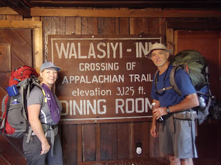
The climb down from Blood Mountain was rocky and steep, but not too long or hard and we made it to the Mountain Crossings Hostel at Walasi-yi (Neels Gap) in record time. 

This historical stone building was built by the Civilian Conservation Corps in 1934.  It was originally a restaurant for Vogel State Park and now houses an outfitter and a hiker hostel.  The A.T. itself passes through the building,marking the only covered portion of the trail's 2100 plus miles.  The white blaze is right on the building where the trail passes through. 
We walked into the store at Mountain Crossings with one thing on our minds.  When asked by the clerk if she could help us, Wait-up said "Yea, we're looking for food."  To which she replied, "We have frozen pizza and sandwiches in the freezer."  "Uh," Wait-up said, "Is there a restaurant close by?"  "Yea, she said about nine miles up the road."  So much for a good, hot breakfast.

Wait-up had a cheese-steak sandwich and I picked out a chicken sandwich, which we heated in the microwave.  We finally found the coffeepot and enjoyed a couple cups of hot coffee with our breakfast out on the patio. 

Before we left we bought us a treat – ooo weee – a Big Sur bar that had to weigh a pound each – we bought three of them for $4 each, total of about 600 calories each too.  But, man-oh-man, was it a good, filling meal and came in very handy for breakfast when we were out of water and couldn’t cook our oatmeal.  (Oh, we split each of them each time so each of us only consumed about 300 calories at a time.)  When you’re on the trail, you don’t worry about calories cause you are burning so many walking up and down mountains.  For once in my life – I ate ANYTHING I could get my hands on.  Plus, they gave us lots of energy for climbing mountains.
We filled our water bottles and camelbacks and headed off again on the trail.
We entered Raven Cliffs Wilderness after leaving Neels Gap and only met a couple of men going south today.  After Tesnatee Gap, we faced what seemed to be the steepest, if not the highest, mountain yet – Wildcat Mountain.  Why is it that the smaller obstacles seem to be the hardest to overcome?
We passed Whitley Gap Shelter on purpose – in our planning we noticed that this shelter is 1.2 miles off the trail (DOWNHILL!) so we determined early that we would not plan to stay here for the night and add 2.4 miles to our already-long-enough journey.  Whether that was a good decision or not was yet to be seen, since the shelters are the best place to count on getting water, which we were now getting low on again. 
The empty water hole at Hogpen Gap.
We continued on to Hogpen Gap where our Hiker’s Companion indicated that we could find water.  The clerk at Mountain Crossings had also confirmed that the water supply at Hogpen Gap should be sufficient – oops, we found an empty water hole there.


After Hogpen Gap, GA 348 Highway, we entered Mark Trail Wilderness.  How many wildernesses have we been in so far?  Three, I think. 


A quick check of the Hiker’s Companion told us that the next water would be at the next shelter, Low Gap, 4.4 miles away, so we were forced again to ration our water overnight in order to make it last to the next watering hole. 
When we passed up Whitley Gap Shelter, we felt confident that we would find a campsite along the trail to spend the night.  Although there was not one indicated in the book, we had found that usually there were campsites regularly spaced on the trail where people had camped before even if they were not “official” campsites.  And indeed there was one not far from Hogpen Gap, BUT we had read that we should not camp close to the gaps where a road crosses, so we continued on….  (I didn’t have a good feeling about this by this time.)
This had been our longest day so far.  We had been walking since 7:45 this morning and it was now 7:00 at night, we had to find a place to set up camp.  Seeing no established campsite, we decided to make our own, so we began to look for a level place to set the tent.   We cleared an area between the trail and the mountain edge and got set up and the bear bag hung just before dark fell. 

Our campsite in the middle of nowhere.

I heard things all night long!  I didn’t sleep, and poor Wait-up didn’t sleep much either cause I kept waking him up to tell him that I heard something outside.  I told him I didn’t want to be by myself and as long as he was asleep, I was by myself.  He was a good sport and even got up and blew his whistle outside the tent once to run off whatever it was I heard.  I was sure a bear would come to our tent that night.  I’ll admit it – I was scared! 

Well, right before dawn the next morning, I REALLY DID hear something!  It sounded like a herd of animals coming up the hill from the trail toward our tent and there was a BUNCH of them.  I woke Wait-up up again and he heard it too this time.  He got out of the tent (my brave man!) and looked around. He didn’t see anything!  But we could both hear them getting closer.  He shined his light down the hill and still did not see them.  He shined his light toward the bear bag hanging in a tree some distance from the tent, but didn’t see anything.  He began to blow his whistle and we could both hear whatever it was scurrying off in a rush away from us.  He still did not see them! 
The only thing we could think was that whatever it was must have been too short for him to see above the underbrush, maybe turkey? 

Now I was REALLY scared!  So we got up before daylight and hit the trail again.  As we started out, we saw where something had rooted up the ground all around our campsite and all along the trail.  In a little while we met a man who was obviously a hunter who asked us if we had seen any signs of wild hogs this morning.  AH! Yes, that’s what we had heard!  Yes, we had heard LOTS of them and seen plenty of sign.  Mystery solved. 
Now we know why it was called Hogpen Gap!

I determined then that I would not spend the night in the wilderness anymore.  It would have to be a shelter or an established campsite for me!    
Views from today around Levelland Mountain


Woody Gap to Blood Mountain Shelter

Day Four -  Monday, October 3
8.2 miles in 6.5 hours
Woody Gap to Blood Mountain Shelter


Wait-up on Preacher Rock.

We left Woody Gap in good spirits this morning after a restful afternoon and evening yesterday.  First hurdle, uh – mountain – Cedar Mountain.  We reached Preacher Rock and enjoyed a beautiful view from there. 
Had lunch on Burnett Field Mountain, then entered BLOOD MOUNTAIN FOREST…
 Ah, the day we have been dreading for some time now.  Blood Mountain rises 1200 feet above Jarrard Gap in 2.6 miles and looks ominous from below.  At one time, we had considered reversing our direction on part of the trail just for convenience but when we considered conquering Blood Mountain from the north and saw that it was even worse (1325 in 2.4 miles), we changed our minds.  On the shuttle ride up to Woody Gap though, Willie, who works at the Hiker Hostel filled us in on the trail and told us that although Blood Mountain is high, the climb is not steep but has lots of switchbacks.  That gave us hope, and thankfully, he was right.  (Thanks for all the information, Willie.)
We later found out that Willie is a local athletic celebrity. (http://natureboyhiking.com/)

Us at Slaughter Creek before climbing Blood Mountain.
On the way up, we stopped at Slaughter Creek Trail at the bottom of Blood Mountain to cook our supper.  That would mean less water weight we have to carry up the mountain! 
We are using water each evening to rehydrate our minute rice to go with whatever meat we have, tonight it is a packet of Starkist chicken. 
We planned to skip our oatmeal in the morning and eat when we get to the store and hostel at Neels Gap. 

This morning, I finally found the music on my Ipod.  As I dragged my feet through the trail, I got a second wind and picked up my pace to the music.  One song that meant something to me today was “Taking My Time” by Susan Ashton.  Made me think about all the things I haven't done yet.

The world is turnin'
Telling me to hurry on
You gotta run to get ahead
Try to take the things you want
But when the sun begins to set
So many things I haven't done yet

Oh, but I won't worry
‘Cause there's no hurry
The world's not passin' me by
‘Cause the Lord he knows
Just where each day goes
I know He won't leave me behind
And I won't be bringin' a single thing
That my heart can't carry inside
‘Cause I'm goin' home
And I'm only takin' my time


We made it to the top of Blood Mountain in record time.  Not a bad walk at all, many parts of the trail we called “Hiker’s Paradise.”  We had plenty of energy left when we arrived at the top.  Lack of water weight did indeed make a difference.  We could have continued the next 2.4 miles to Neel’s Gap, but I thought it would be neat to view the sunset from the highest point on the Georgia AT trail.  And it was neat.    But we regretted that decision several times later on because it put us about 2 hours behind for several days and cost us a day when we got to Unicoi Gap on Thursday morning instead of Wednesday evening.
The evening was spent on the tip-top of a huge rock watching the sun set.  It was a beautiful site. 


Enjoying the view from the highest point on the AT in GA

“Jaybird” flew in talking about his experience trying to find water where there was none at Slaughter Creek.  He had to get his water out of a puddle and it was NASTY. He boiled it and drank it anyway and continued on down the hill to Neels Gap to stay in the hostel for the night.

Sunset on Blood Mountain.

After the sun set, we went into the back room of the oldest shelter on the AT, made of stone, the Blood Mountain Shelter.  Another man had beat us to the front room.  There were no windows or door on the shelter.  We rolled our sleeping mats and sleeping bags out and went to bed.  There was a nasty cold wind blowing in the window which made us feel as though we were sleeping outside. Thank goodness for our warm sleeping bags!

Soon, Wait-up said in the dark, “Oh, I forgot about the mice.”  What??  “They said the mice were bad in the shelters and we need to hang our backpacks up so they can’t get to them.”  So he got up and did just that and we went to sleep.  In a few minutes I was awakened by the flashlight.  Wait-up had heard a mouse chewing and turned on the light to catch him chewing my backpack hanging up on the peg.  So much for keeping them out.  We slept fitfully, what with the mice, the wind, and the man in the front room snoring.  I was sure he would wake up in the morning with rat holes chewed in his socks, he didn’t seem to be aware that he was sleeping with mice.