Showing posts with label James River Foot Bridge. Show all posts

James River Foot Bridge to Punchbowl Shelter

Monday, March 30, 2015
Day One - James River Foot Bridge to Punchbowl Shelter
10.5 Miles

Our 7:15 breakfast at Three Springs Hostel was very delicious and filling--scrambled eggs, bacon, toast, fruit and yogurt, and coffee. 

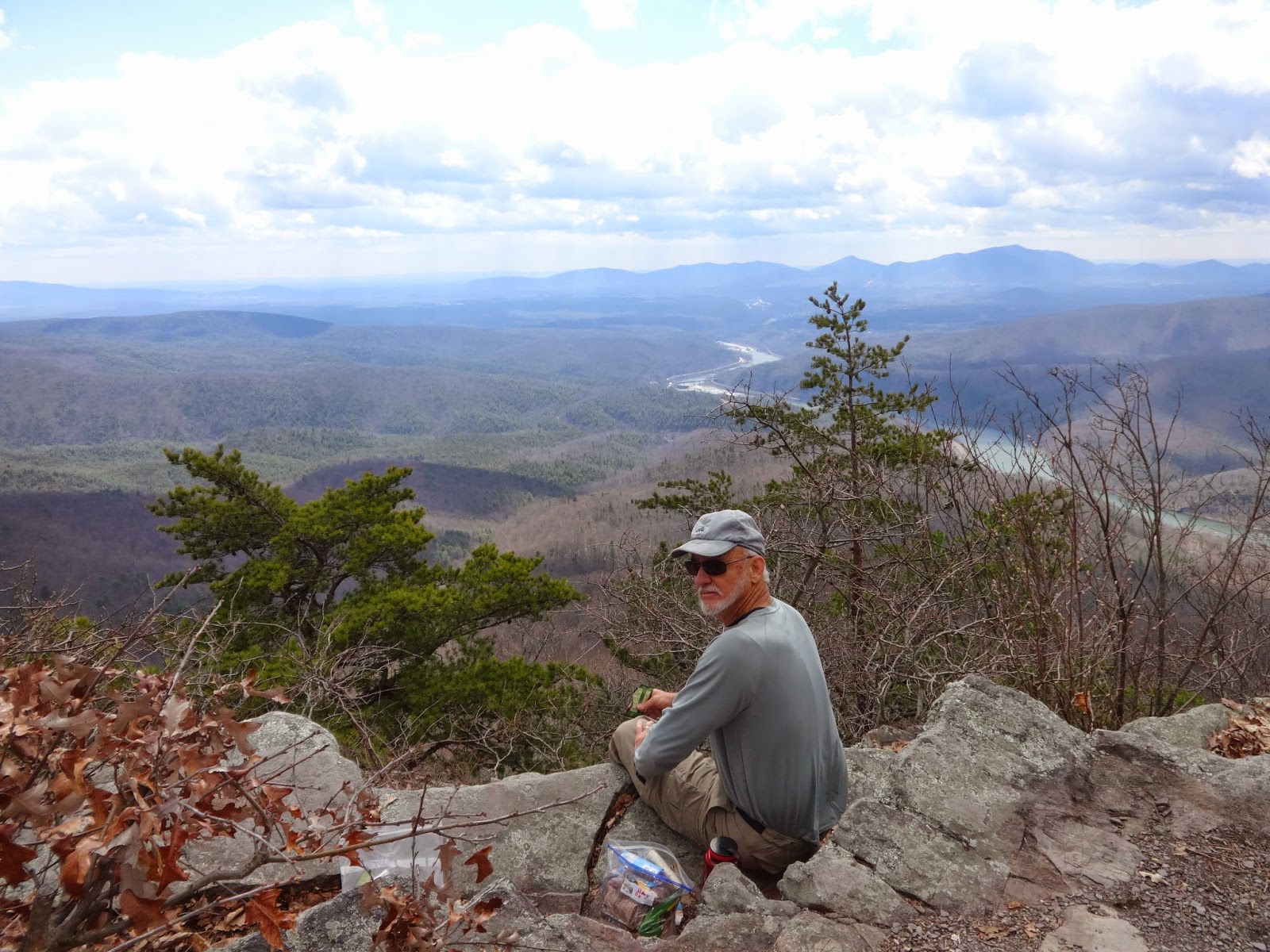
Me at James River Foot Bridge
At 8:00 we started our drive to the James River Foot Bridge and was hiking by 9:15.  We only planned to do 10.5 miles today because we knew we might get a late start and also because it would be our first day back on the trail.  The first day is always hard. 

We had a long steep climb up to begin with to get to Big Rocky Row Trail.  We had lunch at the top, overlooking the James River below.  The high today will be 58 degrees, it is windy and cold on the west side of the mountain. The sun peeked out only occasionally and I so wished that it would stay. 

We had a magnificent view of the James River for most of the morning.  So peaceful. 

Another steep climb took us to the top of Bluff Mountain. At the top of the mountain we saw a monument to four-year-old Ottie Cline Powell.  In the fall of 1890, Ottie went into the woods to gather firewood for his schoolhouse and never returned.  His body was found five months later on top of Bluff mountain, seven miles from the schoolhouse.  Someone had left a little blue toy dinosaur on the monument.  Sad. 

 It was a slow go, but we finally got to the shelter around 4:45 p.m.  Surprisingly, there were two men already there.  They were out for a week and had zeroed the day at the shelter today.  We had our supper, pitched our tent, and went to bed by 7:00.  Low tonight 38 degrees and windy.
Starting north along the James River
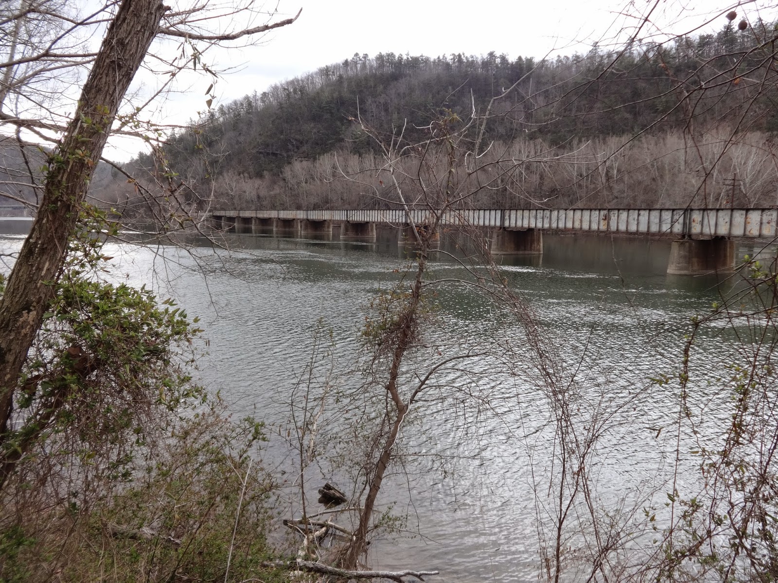
 
  
James River


James River

High above the James River

Looking over the James River


Monument to lost boy


Punchbowl Shelter

Pond at Punchbowl Shelter


Cornelius Creek Shelter to James River Foot Bridge

Cornelius Creek Shelter to James River Foot Bridge
Day Nineteen – Friday, April 11, 2014
19.9 miles
8:45 a.m. to 6:30 p.m.

Karen joined us at the Comfort Inn this morning at 6:30 and followed us to James River Foot Bridge to drop off our car.  Then we drove back to Cornelius Creek Shelter where we will begin our hike. Pop Pop rode up with Karen and picked her brain all the way.  Maybe he didn't mind so much that he had to make the long ride with us to James River Foot Bridge and back before he started his hike. 

Back at Cornelius Shelter, we made one last search for our camera - to no avail.  I left a note in the hiker register just in case someone found it later so that they could get in touch with me.  Then we headed north, starting about 8:45.  Pop Pop took off before we did and we didn't see him again for a couple of hours.  He must have a new lease on life today as he seems to be moving faster than he said he did yesterday. 


Our new friend and shuttle driver, Karen Dillard aka Hiker Mom
with the James River Foot Bridge in the background.

Each day during our ride up the Blue Ridge Parkway we have been seeing a white dome sitting on top of a distant mountain.  It seemed so far away, but today we finally reached it.   Apple Orchard Mountain (Elevation 4,225) is  the highest point on the Blue Ridge Parkway in Virginia.  The summit is an open bald just right for a leisurely break.  The dome, we found out, is a Federal Aviation Administration  radar device. It was neat to finally be standing just below this towering dome after having seen it from afar for several days. 
 
According to the Thru-Hiker's Companion, Apple Orchard Mountain was once the site of Bedford Air Force Station consisting of barracks and support buildings for 250 people.  The Station was operational from 1954 to 1975.
 
The wind was blowing pretty hard on top of the open bald, and it was time for lunch, so we found a hide-out between some boulders and brought out our lunch.  When we stepped back out onto the grassy area, we found Pop Pop sprawled out resting. 


The FAA Radar device on top of Apple Orchard Mountain.
Our lunch spot on top of Apple Orchard Mountain was a
hidden boulder pocket out of the wind.
Our new friend, Pop Pop enjoys a break on
Apple Orchard Mountain.


You will enter Thunder Ridge Wilderness just before The Guillotine. One of the highlights of today's hike was The Guillotine, a large rock boulder suspended over the trail in a narrow rock canyon. I have seen pictures of individuals sitting on top of the Guillotine, but it never occurred to me to try to get there.  So we just stood under it for our pictures. 


After passing the Guillotine and Thunder Hill Shelter, we came back out of the wilderness to the Blue Ridge Parkway around mile 74.  Here we found Thunder Ridge Overlook, a beautiful stone wall with a magnificent view of the valley to the north.  
 
Beautiful view from The Blue Ridge Parkway

 Thunder Ridge Overlook


From Petites Gap, USFS 35 at Blue Ridge Parkway mile 71, the climb begins up to Highcock Knob after entering the James River Face Wilderness.  Highcock Knob is a memorable, tough climb--rocky and steep. Our feet were beginning to show signs of blistering and we were getting quite weary. 

Our first view of the James River from high in the mountains was a welcome sight.  It appeared to be "just right down there" but we didn't reach it for quite some time later.  We crossed a couple of springs during our long descent, then crossed a pretty large creek before coming to Matt's Creek Shelter. 
First view of James River.

Matt's Creek Shelter
 
The trail followed Matt's Creek for about a mile before reaching the James River.  There were several nice-looking swimming holes in the creek.  The rocks in this area are reportedly 500 million years old.  We were pleasantly surprised that the trail did not go back up the mountain before reaching the river as we assumed it would (doesn't it always??).

When we reached the river, we thought the footbridge would be right there, but NO!  We had to parallel the river for maybe a mile and a half before we got to the bridge.  We could see the bridge a long time before we reached it.  But reach it we finally did! 

The James River Foot Bridge is the longest foot-use-only bridge on the A.T.  It is dedicated to the memory of Bill Foot, a 1987 thru-hiker whose efforts made the bridge a reality. 
James River Foot Bridge from up the river.

James River Foot Bridge


We crossed the river bridge with mixed emotions.  We were simply ELATED to be finished with this long challenging section. We were tired, our feet were blistered, my feet were killing me from the condition I have been suffering with, and we were ready to go home.  However, we were extremely proud of ourselves for our accomplishment of 19.9 miles on our last day and our 238 miles over the past 19 days.